Aerial photogrammetry
We will teach you everything about collecting and processing data through aerial photogrammetry.
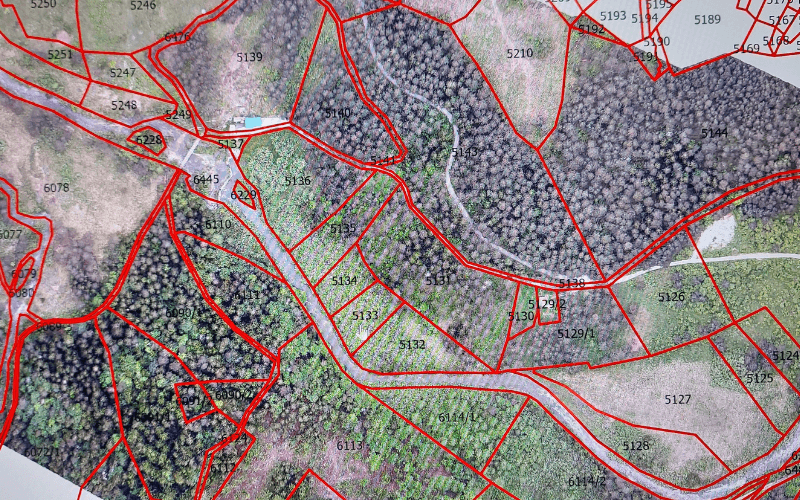
1. For 2D analysis and interpretation of data – how to perform data collection with an aircraft by taking high-resolution and geocoded photos in NADIR recording mode where the point of interest is exactly below the sensor.
2. For 3D analysis and interpretation of data – how to perform a more complex recording that requires photography from multiple angles.


Digital twins
We will explain how to determine what we want to get as a final product and which parameters we want to analyze from the so-called digital twins.
This affects the:
- planning the execution of a flight operation
- selection of the appropriate sensor lens
- determination of orientation points
- photo signaling
- position or orientation of the sensor during data collection
- georeferencing
- GSD
- and the like.
Collected and processed data in digital twins are located in space in a coordinate system.
This gives the possibility of making various measurements and, by combining them with other data through various GIS tools, overlapping and comparing the results.
Understanding photogrammetry can be essential in your daily work.
At Hyperion Drones, we provide specialized, tailored educational programs about basic and advanced usage of photogrammetry using drones and subsequent data processing.
With us, you’ll learn all about collecting high-quality orthophoto imagery and processing raw data into meaningful and usable results.

- Introduction to Photogrammetry:
Understanding the basics, principles, and applications. - Drone Operations for Data Collection:
Comprehensive knowledge of using drones for accurate data collection. - Basics of Data Collection:
Methods of collecting data necessary for photogrammetric methods. - Introduction to Data Post-Processing:
Basics of processing the collected data.
- High-Precision Data Collection:
Master the methods of collecting high-precision data using drones. - Quality Assurance:
Ensuring the highest level of accuracy and reliability of processed data. - Advanced-Data Processing Methods:
Dive into the world of software tools for advanced data processing. - 3D Modeling and Analysis:
Learn how to convert drone-collected imagery into 3D models of relief and elevations. - Integration with GIS Tools:
Learn how to use collected and processed imagery in various GIS tools.
- Post-Incident Mapping:
Apply photogrammetric methods in rapid data collection and processing post-incident. - Decision Support:
Make the collected data a powerful tool for making quality decisions. - SAR Operations:
Optimal deployment of operational forces on the field using collected and analyzed data. - Monitoring Conditions and Changes in the Affected Area:
Periodic imaging for condition monitoring and analysis, change detection, and potential hazard identification.
- Practice-Based Education:
Tailoring for specific application methods. - Scenario-Based Education:
Detailed exploration of real scenarios and adaptation according
- Practical Sessions:
Field exercises for the application of theoretical knowledge. - Expert Guidance:
Learning in real situations under expert guidance.
- Continuous Learning:
Periodic workshops aimed at refreshing and upgrading knowledge. - User Support:
Addressing specific problems and user requests.

By investing in our photogrammetry educational programs, you will learn how to integrate advanced technological solutions.
You will increase your efficiency and capability in data collection and processing.
At Hyperion Drones we are dedicated to achieving excellence, turning raw data into key products in your field of application.
